• Skip to primary navigation
  • Skip to main content
  • Texas A&M Forest Service
  • Texas A&M Veterinary Medical Diagnostics Laboratory
  • Texas A&M AgriLife Extension Service
  • Texas A&M AgriLife Research
  • Texas A&M College of Agrculture and Life Sciences
Coping with Feral Hogs
Coping with Feral HogsTeaching, Research, Extension and Service
  • Menu
  • Home
  • All about feral hogs
    • Feral Hog Ecology
    • Introduction of Feral Hogs
    • Feral Hog Identification
    • Distribution and Expansion
    • Impacts
    • Diseases
  • Feral Hog Management
  • Resources
    • Links
    • Publications
    • Contact Us
    • AgriLife Extension ANR Agent Resources

1982 National Feral Swine Distribution Map

January 27, 2022 by mikayla.killam

Map of the United states displaying feral hog distribution by county in 1982.

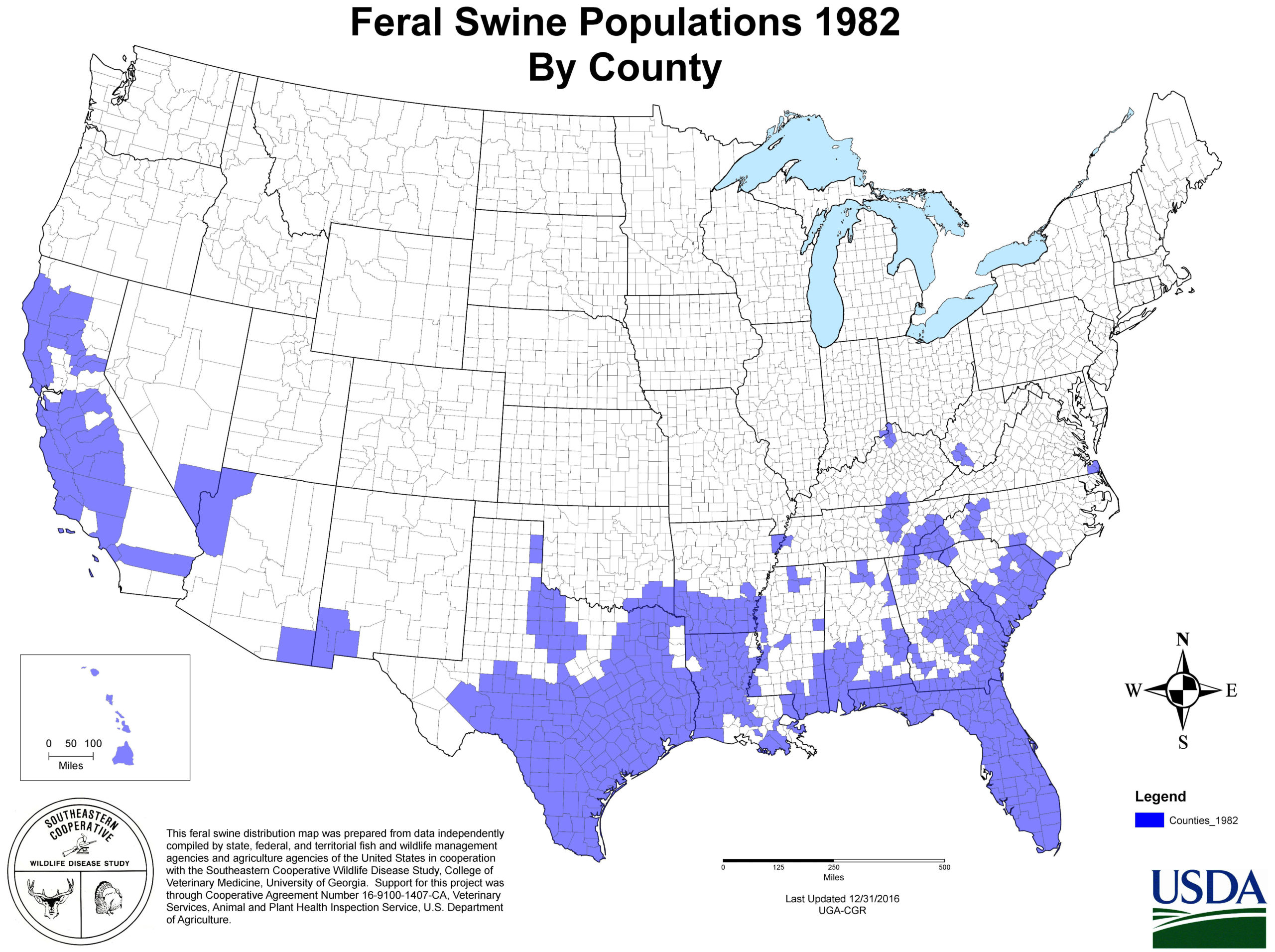
Map of the United states displaying feral hog distribution by county in 1982. Data compiled by Southeaster Cooperative Wildlife Disease Study and partners, Maps provided by USDA.

Texas A&M AgriLife Extension Service
Texas A&M University System Member
  • Compact with Texans
  • Privacy and Security
  • Accessibility Policy
  • State Link Policy
  • Statewide Search
  • Veterans Benefits
  • Military Families
  • Risk, Fraud & Misconduct Hotline
  • Texas Homeland Security
  • Texas Veteran's Portal
  • Equal Opportunity
  • Open Records/Public Information